Cherarda Kasbah
GPS coordinates: 34°03’45.2″N 4°59’29.1″W (34.062563, -4.991409)
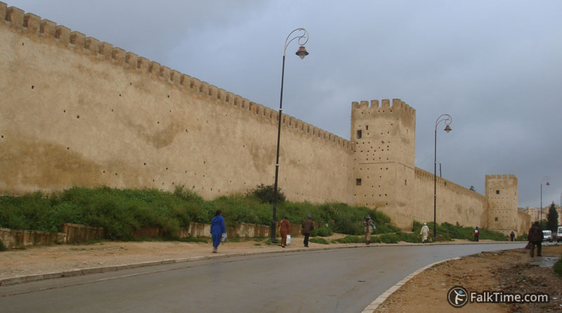
The primary kasbah was built by the Saadians and later it was refurbished by Alaouite sultan Moulay Rachid to house guich tribes. Cherarda is the name of one of these tribes. Rectangular Kasbah is enclosed by a crenellated wall with fortification towers every 50-55 m.
You will pass it by if you go from the old medina or Jnane Sbile garden to Borj Nord. Today there are no old buildings inside of Kasbah. Eastern side houses Ibn El Khatib hospital, while the western side is an annex of the Al-Qarawiyyin University. Only the wall (that is easy to see on the map below) reminds of 17th century.
Map
Take Fez map with you – just click the star and it will be saved in your Google account. Any locations in this region that I will add later will appear on your map.
Cherarda kasbah is marked with orange rectangle:


